Three awe-inspiring hikes in transylvania
Written by Andrew Mattison; Guided by Ildiko Vidican. Instagram handle @druwbie
Awww Transylvania, a land of breathtaking landscapes, cultural diversity, and some great mid-hike mountain snacks. Here, we will explore what we think are the three best hikes in the Transylvanian region of Romania. So pack up your polar fleece and a good pair of boots because it’s all uphill from here!

A view from the cabin halfway up to Pietra Mare, or Big Rock.
Canionul Șapte Scări- Piatra Mare
Difficulty: Easy to moderate (though some bravery is required)
Duration: 5-6 hours, 12km (8 miles) there and back
Entrance Fee: Yes
Park Hours: Closes at dark
The first hike may not be for the faint of heart. Canionul Șapte Scări, or the Seven Ladders Canyon, is a well-known hiking trail and popular tourist spot located near Brasov. The hike features beautiful views on the way up to the peak of Pitra Mare, or, in English, Big Rock. Start this hike by searching Intrare 7 Scari on the map. Just outside of Timișu de Jos, Romania.

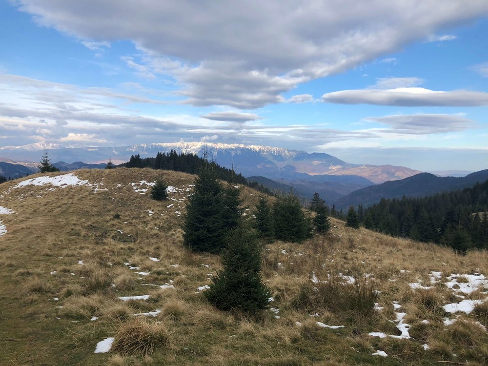
Sweeping views from the top of Pietra Mare where you can even see the city of Brasov in the distance.
The map below provides the exact location to the Șapte Scări trail head.
After a short, easy walk to reach the canyon, the hike really starts with an exhilarating, or perhaps terrifying (depending on what you enjoy in life), climb up the namesake series of metal ladders scaling a series of waterfalls. The mist from the waterfalls, although beautiful and possibly refreshing, coats everything so be cautious while climbing and hold on tight. Now, before you decide to skip this hike while thinking “no way am I doing this crap,” realize that the rest of the hike will reward you with amazing views and completely make up for any positive or negative adrenaline rush you may experience.

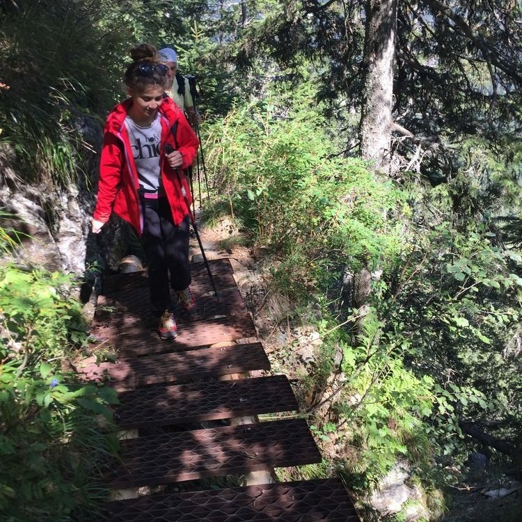
Ladder from Șapte Scări: One of the seven ladders you will encounter on the trail Șapte Scări near Brasov, Romania.
Șapte Scări Canyon leads visitors up several ladders alongside waterfalls. The mist of the water blowing down through the Șapte Scări canyon while hiking to Pietra Mare creates quite a challenge, so it is better to be more experienced hiker or climber if you want to attempt this way.
Now that you’ve escaped this heart-stopping section of the trail, you may be relieved to know there is another way back down so you won’t have to take the stairs again! Trust me, the rest of the mountain will feel like a piece of cake. Big Rock’s grassy knoll-like terrain and panoramic views provide endless incredible photo taking opportunities.
Prior to reaching the summit of Piatra Mare, you will find Cabana Piatra Mare (lodge), which in the past has been open to the public for lodging. No worries if you aren’t able to stop because the summit is not far from the Cabin.

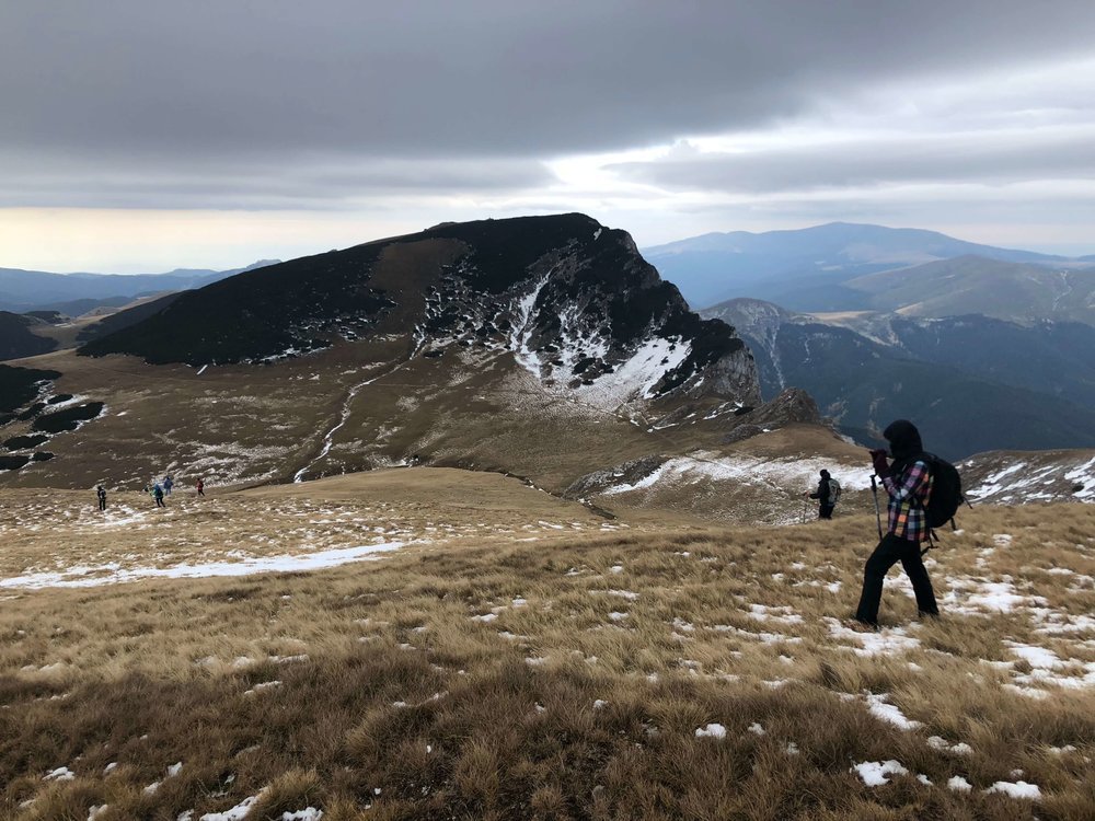
Taking in these amazing views from the hike of to Piatra Mare after getting through Sapte Scari.
Doispe Poduri-Făgăraș Mountains- Summit Negoiu
Difficulty: Difficult
Duration: 6 to 8 hours there and back, 4.4 miles (7.1km) one way.
Entrance Fee: No
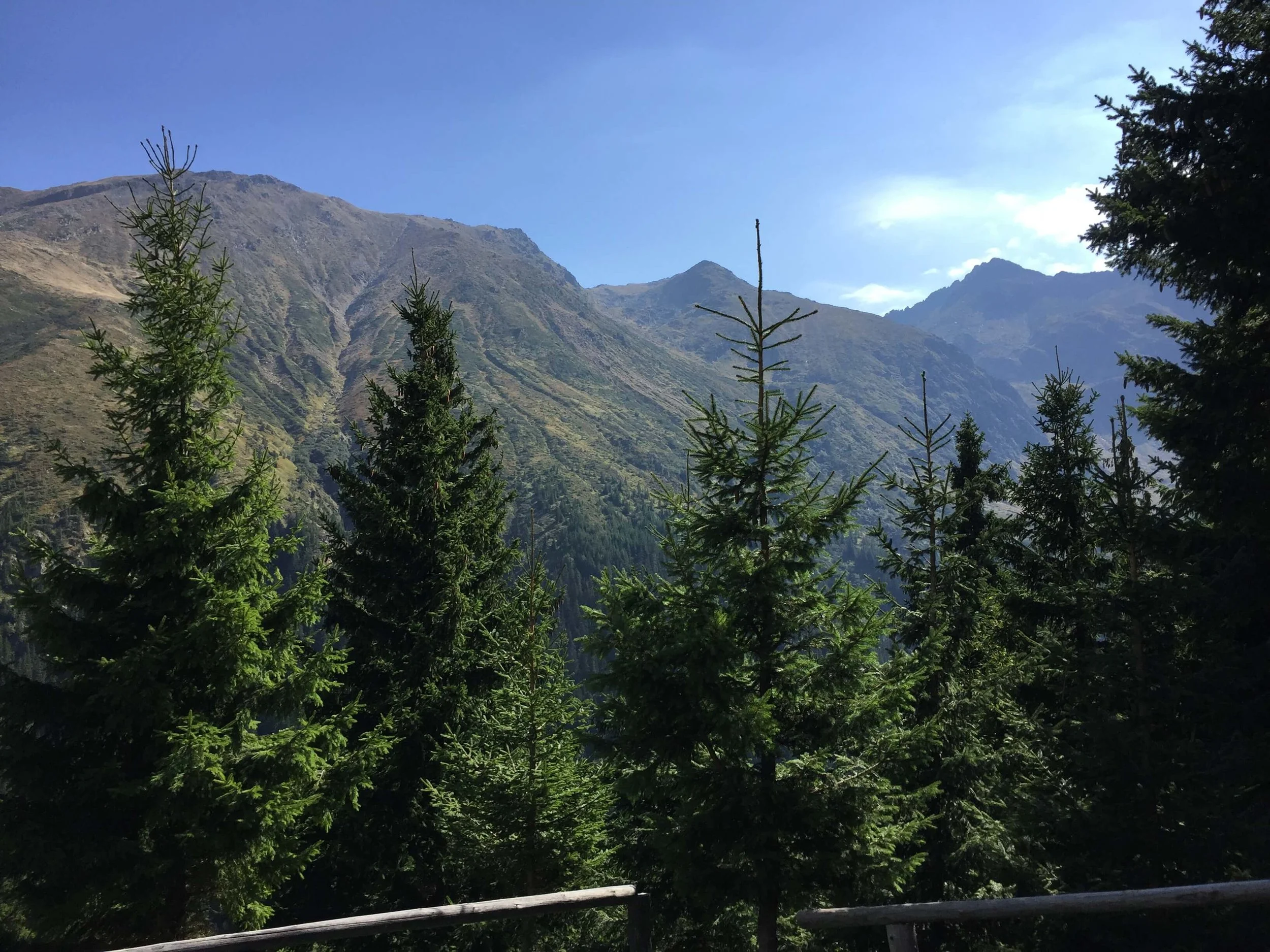
Next on our list is a hike up to the second highest peak in Romania. At 2535 meters (8316 feet), Negoiu is only beat by one other mountain in the same Făgăraș cascade, and that’s pretty impressive when you come to realize it is the 20th highest peak in all of the greater European continent.
To find your way to this hike start by taking the road to Cabana Negoiu -Parcare, which means The Negoiu cabin parking lot. Once you reach this are you will find many cars of fellow hikers parked along a gravel road. The trail between these two locations is Doispre poduri

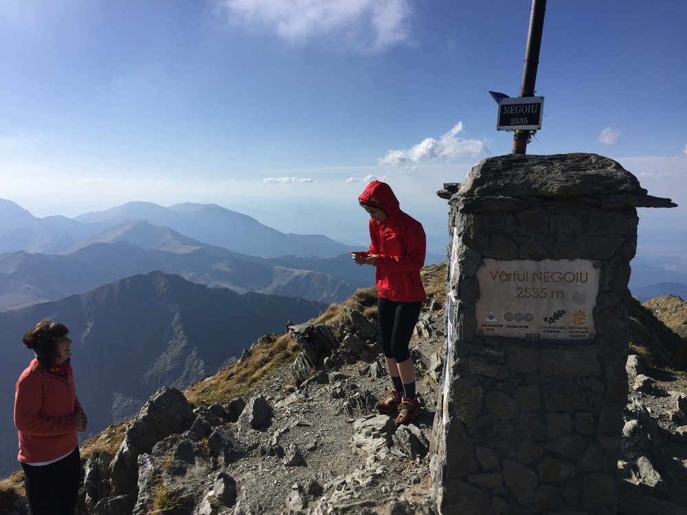
Almost to the top of Negoiu in the Făgăraș Mountains.
Doispe Poduri literally means ‘Twelve Bridges’. Anyone else feel like Buddy the Elf was naming these hikes? But, as you probably already guessed it, there will be twelve bridge crossings throughout the hike. Each bridge provides spectacular views of one of the most scenic regions in Transylvania.
“Ce Priveliste buna” means “What a beautiful view” in Romanian. Locals enjoy being friendly and will appreciate you complimenting the natural beauty their Doispe Poduri in the Fagaras mountains has to offer.
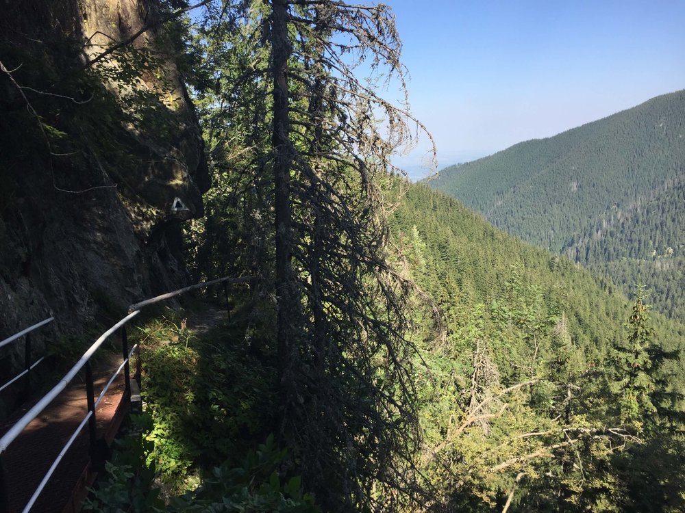
While traversing the bridges be sure to watch your step, the Doispe Poduri hike runs along the side of the steep cliff.
This hike takes around six hours to reach the top depending on your capabilities, assuming you stop for lunch or a couple of breaks along the way this trail should be a perfect all-day hike, meaning around 8-12 hours. That can be very challenging for many people, so if you want to extend you stay, a cabin hosts travelers halfway up the mountain, and the accommodation is pretty a reasonable hostel style with around four beds to room, making this perfect for groups of hikers.
Tip:
The cabin is situated in an epic location and provides a nice opportunity to take a break and share a conversation with your fellow mountaineers and local villagers. Click here to book the cabin on the way up to Negoiu (only available in the summer months).

View from the courtyard of the cabin at sunset. (Doispe Poduri, Fagaras mountains)
After the cabin, you will enter a much steeper terrain that is mostly rocky and can be quite difficult at times even for more experienced hikers. From here, the top can be reached in thirty minutes to an hour depending on how bad you want it. And we know you want it BAD!

In the center of this picture you can see a white dot on the first ridge, which is the cabin hikers stay at on the way to Negoiu.
Once you make it to the top, stop and think about how much of a champion you are. Pat yourself on the back, drink some apa and behold, with pure bewilderment, these incredible and very tall mountains that cradled and protected the local communities for so many years.
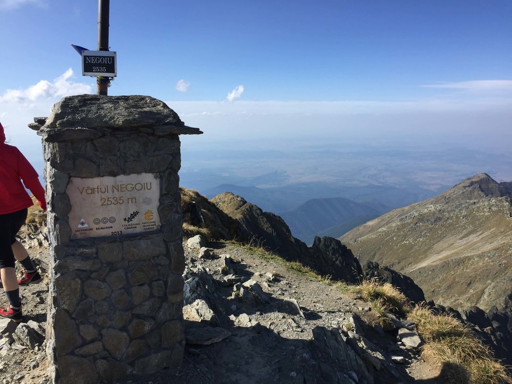
The view from the summit of Negoiu is about 2535 meters off sea level, making it one of the tallest mountains in the continental Europe. If you make it here, you sure can be proud!
Bucegi-Saua Strunga, Saua Batruna
Difficulty: Moderate to Difficult
Duration: 6 to 8 hours there and back, 9 miles (14km) total.
Entrance Fee: No
The last hike we’re going to talk about is closer to Piatra Mare. The name Bucegi to the local is synonymous to the wonderful mountains and outdoors, however it is also a great local beer you have to try!
During nearly the entire hike you will be able to see this incredible view of Piatra Craiului in the distance.
The map below shows you the coordinates of the town near the trail head. Take Strada Valea Bangaleasa, which turns into a gravel road.
Strada Valea Bangaleasa eventually turns into a gravel road and at one-point ends into a trail head. From here take the marker towards Saua Strunga or Saua Batruna, meaning the ‘Narrow Saddle’ and ‘Old Saddle’. Saua Strunga is a red cross (like the swiss flag), and Saua Batruna is a single vertical red band. These are two different hikes but eventually connect. Both offer incredible views and rest areas (Refugiul, in Romaian). Saua Batruna is further away and on the way back you will have the opportunity to pas Saua Strunga.
The hike to the top of Saua Strunga is going to require some endurance. Depending on your abilities and the path you take, it may take you as long as 10 hours to climb up back down, if you take the west side of the trail back down. Trust me when we say it is worth the trek, and after all, there happens to be a cabin on the northwestern side if you need a place to rest up. This cabin, however does not let rooms for the night.

The peak of Saua Strunga in the distance from only an hour in.
The steepness of the mountains can really strain your muscles, while starting off your hike, but hang in there buddy because a little later on, when the forest clears, the terrain will flatten out and gift you with prime 360-degree views.

Popping out of the forested areas you will be able to see Munții Piatra Craiului in the distance.
Depending on the time of year you are making this journey, make sure you bring some warm clothes to protect you against the elements.

Winter is coming.. going hiking in Transylvania means you need to be prepared for the snow!
You know when you are at the top of Saua Strunga or Saua Batruna once you have reached the Refuge. At Saua Batruna you have a small igloo type cabin where you can rest and get out of the strong winds along the summit of Bucegi. Saua Strunga’s Refugiul is more in the shape of a cabin and is not on the sumit of Bucegi.
There will likely be other hikers too considering how popular this trail is!
Conclusion
Wow! Transylvania is a wonderful destination that does not receive enough recognition for its sheer beauty and nature. If you are deciding to hike off the beaten path and visit these three hikes, please let us know how your trip goes. Also, you can tag us in your posts on social media (Links are at the bottom of the page). If you have any questions or are unsure of anything about this post email us or refer to our contact page. Thanks for joining us on this First Time Visiting excursion through the Transylvania mountains. See you next time!
Seen here, making your initial decent from the peak of Saua Strunga in Bucegi.
Thank you Ildiko and Ramona Vidican for all the time we spent exploring Transylvania together.
Connect with Us on Social Media!